Showing posts with label Trekking. Show all posts

Adventurer Plans to Walk the Length of the Congo River

Posted by Unknown on Tuesday, December 30, 2014

Over the past few years we've followed Ed Stafford as he walked the length of the Amazon River, and Levison Wood as he attempted to hike the Nile River from source to sea. Both men spent months on their respective journeys, as they explored the two longest rivers in the world on foot, while simultaneously inspiring others with their efforts. Now, another British adventurer is planning to take on a similar challenge, when he attempts to trek the 4700 km (2922 mile) length of the Congo River in Africa.

The expedition is currently still in the planning stages, and isn't set to begin until the spring of 2016. That is when explorer Toby Storie-Pugh will launch his attempt to Walk the Congo, an expedition that he believes will take roughly 12-14 months to complete.

The journey will begin at the headwaters of Chambeshi River in northeastern Zambia – the very source of the might Congo River itself. From there, the river descends into the Bangweulu Swamp, before merging into the Luvua, and eventually the Lualaba Rivers. Storie-Pugh will continue along that route until he reaches the village of Kisangani, which his where the Congo officially begins. That town will mark the halfway point of the journey, with the toughest section yet to come.

From there, the route will lead into an 800-mile (1287 km) stretch of thick jungle and flooded forestland that will be incredibly difficult to pass through. That same section of the river passes along the equator, making it an incredibly hot and humid region. If Storie-Pugh and his team successfully make it through what will undoubtedly be the toughest part of the trek, they will reach Kinshasa, the capital of Democratic Republic of Congo. From there, they'll have to make one final push to the end of the river at the Atlantic Ocean.


In terms of how much water flows along the river, the Congo is second only to the Amazon. It is also the deepest river in the world, reaching depths of more than 220 meters (720 ft) at certain points. Combine the massive size of the river with the incredibly tough terrain that surrounds it, and you have a challenge more akin to Ed Staffor's walk along the Amazon, as opposed to Lev's Nile excursion.

Toby won't be completely alone on this expedition. He'll be joined by documentary filmmaker Simone Bazos, who will be documenting the project along the way. He is also taking applications for an expedition co-leader to join the squad and help see the project comes to a successful end. You can check out the qualifications for the position, and see that application by clicking here.

Before he begins training for the Congo, Toby will first head to Nepal in the spring of 2015 to attempt to climb Everest. Once that expedition is complete, he'll then turn his attention more fully on walking the Congo. If all goes according to plan, he will set off on the journey sometime in the spring of 2016.

Find out more at WalkTheCongo.com.
More aboutAdventurer Plans to Walk the Length of the Congo River

Best Hike Treks The Simien Mountains of Ethiopia

Posted by Unknown on Wednesday, December 24, 2014

If you're looking for a spectacular destination for an adventure in 2015, than perhaps the Simien Mountains in Ethiopia will make a suitable location. My friend Rick McCharles, the editor of BestHike.com, just returned from that amazing setting, and as usual he has all kinds of great tips and photos to share with readers.

Rick launched his journey in Gondar, a small town that is one of the best places to find guides, supplies, and information prior to setting out into the Simien Mountains. A typical trek through the region – which is both a national park and a UNESCO World Heritage site – takes roughly four days to complete. Along the way, travelers pass through the spectacular Ethiopian highlands, visiting local villages, and encountering amazing wildlife as they go.

For those unfamiliar with the Simiens, they are a chain of mountains that stretch across northern Ethiopia. Rugged and remote, the region features rocky plateaus separated by deep gorges and valleys, and towering peaks. The highest mountains in the Simien Range climb above 4400 meters (14,435 ft), making a dramatic and breathtaking backdrop to the walk.

You can read Rick's account of all four days of his journey – starting with Day 1 – by clicking here. Each of his daily reports include very helpful information for anyone who would like to do this trek themselves, as well as an array of great photographs that he shot along the trek. He offers valuable tips that will make anyone's journey to the Simiens an easier one, and helpful advice on how to make such a journey possible. His Simien Trek information page is especially helpful in this regard, and should serve as a great resource for anyone thinking of visiting this part of the world.

One of the parts of the trek that Rick enjoyed the most was spotting wildlife along the trail. He especially enjoyed seeing and interacting with the baboons that were plentiful in the highlands. Seeing those primates in their natural environment was a real treat, and true highlight of the experience for sure.

This isn't the fist time I've had a friend recommend the Simien Mountains as a great trekking destination. I understand that it a truly spectacular part of the world, and that the people there are incredibly friendly and accommodating too. As you start looking ahead for new adventures in 2015, perhaps you'll keep this trek in mind as well. It looks like it was an amazing experience.
More aboutBest Hike Treks The Simien Mountains of Ethiopia

Outside Names the 20 Most Deadly Hikes in the World

Posted by Unknown on Tuesday, December 2, 2014

Most people don't regard hiking as being a particularly dangerous activity. After all, millions of people go hiking on a regular basis, and most return home without even a hint of a harrowing tale to share with their friends and family. But depending on the destination, hiking can be a serious adventure, and even quite dangerous at times. With that in mind, Outside magazine has listed their selection for the 20 Most Dangerous Hikes, with some surprising trails making the list.

These 20 hikes are amongst some of the most amazing places to trek on the planet, and the locations range from Guatemala to China, to South Africa, and beyond. In fact, there are hikes on the list from just about every corner of the globe, although North America is particularly well represented.

Amongst the trails that make he cut are Huayna Picchu in Peru, a  trail that wanders up an ancient staircase carved out of a mountain by Inca craftsmen 500 years ago. The route climbs more than 1000 feet (305 meters) in less than a mile (1.6 km), offering spectacular views Machu Picchu along the way. But the route is slippery, steep, and crumbling with age, which has earned it the nickname "the Hike of Death."

With its narrow slot canyons, deep gorges, and remote location, The Maze in Canyonlands National Park is another dangerous hike. Just getting there can be quite an adventure, and Outside says that just 2000 people actually go on any given year. Those that do, find a series of twisting, confusing rock corridors that are a clear indication of how the place got its name. The potential for flash floods and rock falls only add to the danger, although thankfully no one has died in The Maze just yet.

Scotland's Aonach Eagach Ridge also earns a spot on Outside's list thanks to its narrow ridge trail, steep slopes, and unpredictable weather. The knife-edge approach to the top of the trails twin mountain peaks is very exposed, often leaving hikers feeling vertigo, and a deep desire to get off the route as quickly, and easily, as possible. Accidents often occur on the descent, as hikers pick the wrong line for their exit from the mountain.

These are just a few examples of the trails that Outside has put on their list. To read the entire collection, and find your next hiking challenge, click here.
More aboutOutside Names the 20 Most Deadly Hikes in the World

Video: New Documentary to Take Viewers on Epic Traverse of Remote Canadian Mountain Range

Posted by Unknown on Friday, November 21, 2014

This video is a teaser trailer for a new documentary entitled Colours of Edziza. The film follows a diverse team of friends and adventurers as they trek through a remote mountain range in the Tahitian First Nation region of British Columbia in Canada. This part of the world remains largely untouched by outside influences, and the team discovered a land that is as rugged, as it is beautiful. Along the way, they also discovered how to work together to overcome the challenges they faced on their traverse of two different mountain ranges.

The filmmakers for this amazing looking documentary are hoping to complete their project, and have launched an Indegogo campaign to raise the funds they need to finish the film. As I write this, they have raised about $10,000 CAD for the project, and are looking to get to $25,000 CAD. I think after watching the trailer, you'll see that this is an interesting adventure doc that deserves to be seen. If you agree, perhaps you can help out a bit with their goal.

More aboutVideo: New Documentary to Take Viewers on Epic Traverse of Remote Canadian Mountain Range

Adventures in Quito: Hacienda El Porvenir – A Base Camp for Andes Adventures

Posted by Unknown on Tuesday, November 18, 2014


Over the course of ten days in Ecuador, I have had the privilege of seeing a number of truly wonderful things, while also staying in some fantastic lodges along the way. If you’ve been reading my posts throughout my travels, you have no doubt seen me mention a couple of these great hotels, several of which I have recommended highly. But nothing prepared me for my stay at Hacienda El Porvenir, a traditional mountain lodge that can serve as your base camp for adventure in the Andes.

El Porvenir isn’t likely to impress on first glance, especially if you’ve visited one of the more modern and upscale lodges in the Quito area. But don’t let the exterior fool you. This is a place that will capture your heart, and call you back for future visits. The hacienda has a charm and character all of its own, and a soul that is pure Ecuadorian.

The main house that makes up the lodge belonged to the same family for six generations. About 15 years ago, they decided to convert it into a hotel, first starting with some very basic accommodations that are not unlike something you’d find in hostel. Over the years, they have expanded the operations, and added on additional rooms and buildings, allowing for El Porvenir to meet the needs of more guests. Those additions include incredibly comfortable suites, family rooms, and options for singles and couples. The result is that the lodge pretty much has something for everyone – and every budget.

The entire hacienda covers more than 1000 hectares (2470 acres) of prime real estate on the edge of Cotopaxi National Park. In fact, on clear days, the massive volcano can be easily seen from the hotel itself. Other prominent peaks throughout the area are visible as well, giving El Porvenir some of the best views in all of Ecuador. All of that land is put to good use as well, as guests can book horseback rides into the highlands, hit custom made mountain biking trails, or go hiking on self-guided or full-guided tours. If you like staying active on your travels, and like to stay at a place that can provide several forms of adventurous pursuits, this is definitely the place for you.

El Porvenir is an Ecuadorian ranch at heart, and it stays true to those origins today. The lodge has an impressive herd of horses, and many head of cattle also roam the fertile grasslands that surround the guest quarters. Several times of year, expert horseman from across the globe visit the lodge to take part in an authentic cattle drive, during which the local chalcas – Ecuadorian cowboys – round up wild bulls for use in regional celebrations, mock bull fights, and for use in the kitchen. These popular rodeos are an Andean tradition that remain popular to this day.

Speaking of the kitchen, the management at El Porvenir has worked hard to create a very tasty menu as well, all with food sourced locally. Their gourmet offerings keep guests very satisfied, with fresh fruits, vegetables, and meats that are purchased from the local communities. As with several of the lodges I stayed in on my trip, the food was definitely a highlight, with the steak filet in gooseberry sauce – made from berries picked right off the mountain – as a true highlight.

My stay wasn’t all about just soaking up the comforts however, as I got to take part in several activities while I was there, including a nice self-guided hike that provided excellent views of the surrounding countryside. But the true highlight was a morning horseback ride into the Andean highlands on a near-perfect day. The ride took us up above 4200 meters (13,780 ft), with Cotopaxi gleaming like a beacon the entire way.

I have to admit that I am not all that comfortable on horseback. Over the years, I have had the opportunity to ride several times, usually in amazing destinations, but for some reason I have never been entirely comfortable in the saddle. But the sure-footed Andean ponies that are in use at El Porvenir are well trained, good-tempered, and extremely easy to ride. After just a few minutes in the saddle I was feeling comfortable and confident, even as we jogged up well-worn trails into the hills surrounding the lodge.

My ride went on for about four hours, with spectacular views at every stage. The thick grasses of the highlands proved to be no impediment for the stout horses, who are capable of carrying large loads, even at attitude. My steed in particular had to work hard, as I am certainly larger than most of the Ecuadorians that I have met on my travels.
Adventurous travelers who want to explore the Andes by horseback will find excellent guides and horses at El Porvenir. Even if you’ve never been on a horse before, they’ll provide you with good training and support, both before and during your ride. I’m told that about 50% of all visitors are complete beginners, but they all do fine once they get settled in the saddle. Judging from my observations, I’d say that is an accurate statement.

While I didn’t get the opportunity to mountain bike one of the outstanding trails at El Porvenir, I did get to see the bikes that guests have at their disposal. They include some top-notch models with disc breaks, full suspensions, and carbon fiber frames. Often times when you visit a lodge such as this one, you get bikes that are old, and lacking features. That isn’t the case here, allowing visitors to ride with confidence. That certainly makes for a much better experience for both new and experienced riders alike.

As I’ve said previously, one of the things that has impressed me the most about Ecuador is how friendly and accommodating the people are. Everyone I have met has been incredibly hospitable, and that includes the staff at El Porvenir. From the moment you arrive, to the time you checkout, the staff is courtesy, professional, and quick to assist. That includes the front desk managers, the cooks and waitresses, and the friendly ladies who deliver hot water bottles to your door each evening, and light the wood burning stoves in the suites. You’d be hard pressed to find a friendlier crew in any mountain lodge around the world, and I believe it is that level service that keeps brining customers back.

If you’re planning a trip to Ecuador yourself, and you’re looking for an unforgettable place to stay, you really do owe it to yourself to book a room at El Porvenir. With options for every budget, great food and service, and plenty of adventure activities on site, this is a truly great lodge. Whether you just want to relax in a serene, picturesque setting, or fill your days with hiking, horseback riding, and mountain biking, you’ll no doubt be charmed by this Andean retreat. It is fun, romantic, and comfortable, with distinct feel that is unlike any other place I have ever stayed. Truly a great Ecuadorian escape.

Tierra del Volcan, the company that owns El Porvenir, also has two other Haciendas in Ecuador, and can arrange a number of other adventures for you in the country as well. Be sure to check out their website to see what else they have to offer. 


More aboutAdventures in Quito: Hacienda El Porvenir – A Base Camp for Andes Adventures

Adventures in Quito: Hiking in the Shadow of Cotopaxi

Posted by Unknown on Monday, November 17, 2014

For most of my trip to Quito I had Internet access, and was able to write about my days events as they happened. On the final few days of the trip, I was in a mountain lodge that didn't have Internet, so I continued to write about my adventures so that I could share them when I got back home. I'm now getting back to my regular routine, but still have a couple of stories to share. Here's the first one about a day I spent trekking in Cotopaxi National Park.

After two straight days of gray clouds that hung low over the Earth, it was a relief to wake to sunshine and blue skies. That meant that my last day of trekking in the Andes would at least get off to a good start, and we might actually see some of the amazing scenery that had been teased over the previous two hikes. It seemed that the day was looking up, and I hadn’t even rolled out of bed yet.

Unfortunately, that feeling wouldn’t last long. When I did roust myself from the massive and comfortable bed at the Santa Ana Hacienda, I discovered that I wasn’t particularly feeling well. I’m not sure if it was the altitude or something I ate the night before, but there was definitely some stomach troubles brewing. Never the less, I was determined to hit the trail, as this was the day we would be hiking in Cotopaxi National Park, right in the shadow of the massive volcano itself.

After a quick breakfast (my stomach wasn’t much interested in food) we checked out of the Santa Ana and set off on the road to the park. Traditionally, the trek I was doing would have begun on foot at a different lodge, but my friends from Tropic were doing me a favor by showing me this route, so we had to take accommodations where we could find them. A short drive down the road put us in the national park however, and we soon transitioned to foot.
As expected, the clear skies afforded us some amazing views of the mountains that surrounded us, including Pasochoa, a 4199 meter (13,776 ft) peak that we had summited just two days earlier. But of course, the real crown jewel was Cotopaxi itself, and the gigantic volcano didn’t disappoint. It stood out starkly against the clear blue skies as clouds lightly drifted by just below the summit. It was an impressive, awe-inspiring sight, and most definitely worth the wait.

We set off across the open grassland at a steady pace with the snow-capped summit of Coto gleaming in the sun. It was impossible to ignore the giant mountain, which loomed overhead, despite the fact that there were three or four other prominent peaks that were also clearly visible from the trail. Cotopaxi is a mountain that demands attention with its beautiful, yet rugged lines, and massive presence on the landscape. 

The trail began as an access road, but soon turned into a series of twisting routes made by other trekkers, and the wild animals that inhabit the park. Before long, we were wandering through narrow valleys, up steep hills, and over prairie lands inhabited by numerous wild bulls and horses.

About an hour or so into the trek, we turned up an embankment out of one of those valleys, and climbed to the highest point of the day. It was the top of a hill that stretched roughly 3950 meters (12,959 ft) into the air, providing fantastic views of the surrounding countryside. It was a spectacular sight, and on a clear day, it was easy to see for kilometers in all directions. 

The site was so good in fact, that the ancient Incas liked it as well. More than 500 years ago, they built a fortress on top of that hill, and used it as a lookout point and way station for travelers. Some of the walls from that fortress remain to this day, marking the history that the region has witnessed over the centuries. 

The climb to the top of the hill wasn’t a particularly challenging one, but it was enough to get my already delicate stomach even more upset. I found myself laboring to hike to the top, and while there, it took longer than normal to catch my breath. Up until that point, I had been feeling fine, but the labor of the climb had kicked me into another level of suffering. For the rest of the hike I’d struggle to maintain a solid pace, and felt the energy drain from my legs in an unusual fashion. Fortunately, I never actually got sick, but the rest of the trek was a challenge when it really shouldn’t have been.

This hike is the third in a four-day lodge-to-lodge trekking itinerary offered by Tropic. The route is perhaps the most beautiful of all, but it truly shouldn’t be a very difficult walk. In fact, most of the time you didn’t need to use trekking poles at all, although Tropic definitely recommends you bring them. For the most part, the hike crosses over open landscapes, with just grasslands surrounding you. On occasion it does wander into rubble fields left over from previous eruptions of Cotopaxi, or up into the high-alpine marshlands, where the same thick, tall grass that plagued me on Pasochoa two days earlier attempted to make life hard once again. 

After descending from the Inca ruins, we struck out across open fields towards some natural springs that crisscross the national park landscape. These incredible clear – and incredibly cold – streams were a source of tranquility as we hiked along their banks. Fed by the glaciers on Cotopaxi, the water rushes down hill to join ever-enlarging rivers, which provide a steady source of water to Quito and other towns in the region. 

As we continued upstream, we actually came across the source of one of the babbling brooks. Our trail passed right over the point where the water broke out from its subterranean well, and gushed out onto the land above. It was at that point that we reached the furthest point of our trek, and started to loop back towards the end point. Cotopaxi had been on our right all morning, but was now shifting to the left as we started towards are finishing point at lodge called Tambopaxi.

On this day’s hike there were four of us crossing the wide-open fields. Our head guide Fabian lead the way, and I tried to follow close behind, although me waning energy levels made it difficult to keep up at times. We were joined by two representatives from Tropic – Javier and Carmen – who answered my questions about the trek as we walked, Typically, a group on this trek ranges in size from 2 – 6 clients, plus a guide, which is the perfect size for an adventure like this one. Anything larger becomes too cumbersome, and the fitness level to the group can vary too greatly as well. On this day, I would have said that we were all well matched, although I found myself the one who was lagging. 

By the time we started our return trip, some low hanging clouds began to move into the area, and the view of the summit of Cotopaxi became obscured. For the most part, it was still a very lovely day, but the telltale shift in the Andean weather was on the horizon. As we walked, we spied some of our locations from previously in the day from the distance, including the Inca ruins, which stood out at the top of the hill. We also encountered more wild bulls and horses as well, all of which scurried away at our approach.

Finally, we made the final push up, and out, of the valley below, and found Tambopaxi lodge, where our van was waiting to hurry us along to our next destination. For me, this marked the end of my travels with Tropic, as they dropped me off at the El Porvenir lodge, where I would spend the next two days before returning home to the states.

Traditionally, the Tropic mountain lodge trek would actually have one more leg. On the fourth day of that itinerary, the group leaves Tambopaxo and hikes up to the glacier line of the Cotopaxi, which is located at about 4800 meters (15,748 ft). While I would have liked to have been able to go for that final stage, considering my low energy levels after today’s hike, it would have been a tough slog for sure. 

Fortunately, an afternoon of rest at Hacienda El Porvenir has helped me to recover to a degree. Tomorrow, I’ll go horseback riding in the Andes, as that is one of many activities that the lodge offers. Visitors can also take in additional hiking trails, go mountain biking, or simply enjoy the ambiance that surrounds the traditional Andean farm/ranch setting. While very different from the other lodges I’ve stayed in on this trip, it provides a setting that fits in amazingly well with the Andean traditions.
More aboutAdventures in Quito: Hiking in the Shadow of Cotopaxi

Adventures in Quito: Trekking the Andes Highlands

Posted by Unknown on Wednesday, November 12, 2014


If you read yesterday's (admittedly long) post about my adventures in and around Quito, Ecuador, you probably already know that the Andes highlands can be a challenging place to go for a hike. The weather is unpredictable – especially during the rainy season – and the trails can be steep, difficult, and often completely hidden by high grass. It was with that in mind that I woke up this morning in the incredibly warm, and comfortable, Cotopaxi Pungo lodge wondering what I'd face on my second day of hiking in the Andes. Turns out, I needn't have worried at all, as today's trek was very leisurely,  not to mention rain-free, while still providing plenty of wonderful scenery to enjoy along the way.

After yesterday's very soggy trek, I had set my trekking gear close to the fireplace in my room at Cotopaxi Pungo, and overnight, most of it dried nicely. The lone exception was my boots that still felt damp. Knowing that I needed to have good, sturdy shoes for today's walk, I dug out my thickest pair of socks, and slid them on. Then, with a bit of trepidation, I slid them into the boots in question, only to hear a resounding sloshing sounds, and feel the socks already begin to dampen. This wasn't a good start to the day, but there was nothing to do but grin and bear it. 

Fortunately, the weather outside didn't appear like it would be sending rain our way anytime soon. The clouds were once again hanging low, obscuring visions of the surrounding mountains for the most part, but it at least seemed like we'd get off to a dry start. So, after grabbing some breakfast, I returned to the trail with my guide Fabian, who led me to the summit of Pasochoa yesterday, and Carmen, a representative of Tropic  the adventure travel company that has been introducing me to one of their itineraries. The company does everything in Ecuador, including taking visitors to the Galapagos Islands, the rainforest, and the Pacific coastal region. 

Before we set off, I was informed that we were not granted the normal permit needed to hike the trail that was on the schedule for the day, so we'd be walking an alternate route along a road instead. Apparently, since we weren't scheduled to say in a certain hacienda along the route, the permits were withheld, so we had to make the most of the situation. Hearing this news, I was wondering what we might miss out on along the way, as trekking a road didn't sound like a lot of fun. It turns out the road runs almost parallel to the trail anyway, and we were still treated to some excellent views along the way. It should also be noted, that we probably encountered a half-dozen cars on the dirt and cobblestone route, and perhaps eight or ten other people walking it as well. In other words, it wasn't crowded, and it still afforded us a great connection with the Andes forests and grasslands that are common in this area.

Today's hike was to follow the Pedregal Trail, which winds its way along the Pita River – a source of water for the valley below. The Pita begins on the glaciers of Cotopaxi, and its runoff helps to sustain life in the region. But as noted, we had to take a detour, and while we were no longer following the Pedregal, we were essentially on a parallel route. 

The morning air felt cool and damp, but upon striking out from the lodge, we were soon plenty warm with the exertion of the hike. The road went over, around, and down, some rolling hills, while the clouds played peekaboo with the surrounding scenery. Nearby, Cotopaxi loomed large, but its summit remained hidden by mist and cloud cover. At one point, even Pasochoa, yesterday's big challenge, appeared from behind the fog, giving us a brief glimpse of where we had been just 24 hours earlier. 

About 45-minutes into our walk, a black puppy joined us on the trail. We weren't really sure where he came from, but he soon fell into stride along side of the three of us, as we made our way through the highlands. He stayed with us throughout the entire day, enjoying the walk as well it seems. The friendly pup showed no indication that he wanted to return to wherever he had left, and the dog was with us as we arrived at our lodge at the end of day. In fact, he seems to have already been adopted by the staff, and has made friends with the llamas that graze on the grounds. 

As our day wore on, the clouds dissipated some, giving us a better look at the surrounding countryside. What we saw were rolling hills covered in incredibly fertile grasslands, which were perfect for farming and grazing of livestock. Many of the fields we passed had horses or cattle in them, and small homesteads dotted the landscapes. Occasionally, one of the farmers could be spotted going about the days chores. Any that past close enough to see our wandering trio were quick to greet us with a friendly "hola" or "buenos días." The warm and inviting people of Ecuador are found high in the Andes as well it seems. 

Around noon we stopped for lunch, and were soon greeted by the six mountain guides that had accompanied us on our Pasachoa summit, and soggy trek from yesterday. They were walking the same route as us, and had started a short time after, but had caught up just as we sat down for sandwiches and snacks on a covered bench. It was a lively and fun reunion for all involved, as it seemed like we all shared a common bond following the mountain storm we had survived together the day before. Our combined groups would hike the final section of the road to our lodge together, with much laughter to be had along the way. 

As the afternoon drew on, the sun even poked out from behind the clouds, and blue sky appeared overhead, That made for a pleasant walk to the Hacienda Santa Ana, a historic hotel that was once home to the Jesuit priests that came to the area. It has been restored, and looks fantastic, with beautiful and comfortable rooms as well. The restaurant serves wonderful gourmet meals too, which make it a wonderful destination following a long day on the trail. 

Tomorrow, I'll spend just half of the day with Tropic doing yet another trek, this time along the Cotopaxi Trail. It is said to be another relatively easy hike, and we're predicted to finish up by around noon or so. Hopefully the weather will cooperate, and provide us with some good views of this awesome mountain. It has proven somewhat elusive over the past couple of days. Once I'm done with the trek, I'll then transfer to the Tierra del Volcan, a lodge that sits right on the edge of Cotopaxi National Park, where I'll spend my last couple of days in Ecuador before returning home. 

The trip so far has been filled with wonders, both cultural and natural. Ecuador is a wonderful place for adventure travelers, as it has so much to offer outdoor enthusiasts. But the thing that will stick with me the most upon my return to the U.S. is just how friendly and hospitable the Ecuadorian people are. Everyone I have met has been incredibly accommodating and polite. That is a wonderful impression to take away from any destination. 
More aboutAdventures in Quito: Trekking the Andes Highlands

Adventures in Quito: A Mountain Trek During Which Ecuador Reminds Me That it is The Rainy Season!

Posted by Unknown on Tuesday, November 11, 2014

One of the activities I've been looking forward to the most since arriving in Ecuador is trekking in the Andes. Don't get me wrong, I've loved everything else I've done so far, and the good people of 
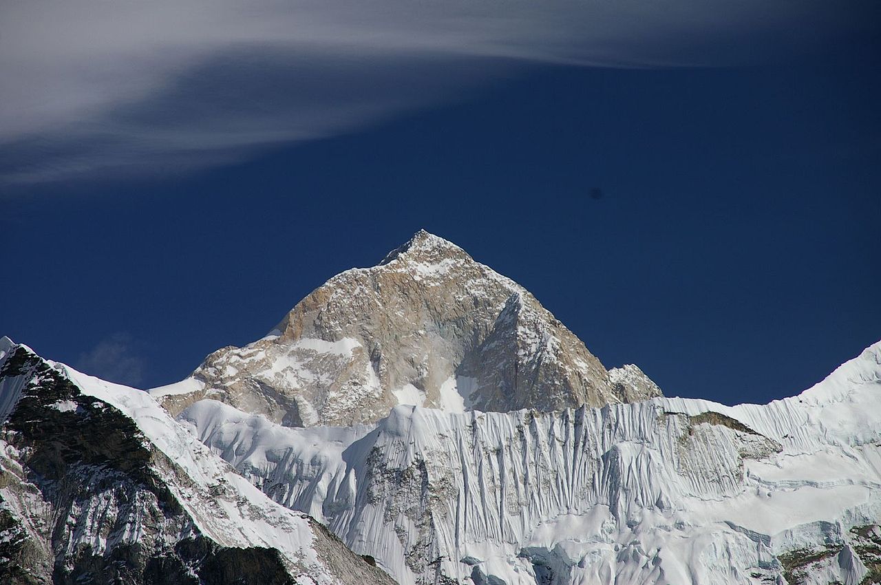
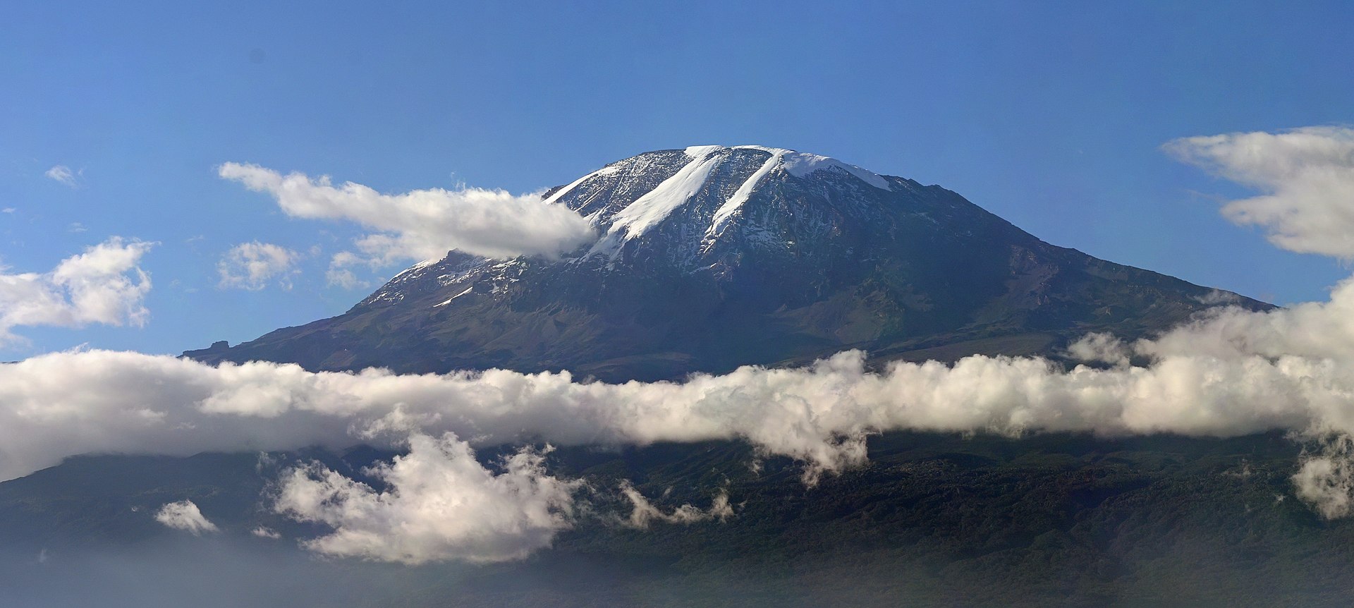
Quito have been incredibly accommodating and friendly. On top of that, over the past couple of days, I've had the opportunity to mountain bike down Cotopaxi – a 5897 meter (19,347 ft) volcano – and visit a lake inside a volcanic crater that is simply breathtaking. But I love to hike and climb, and was ready to really stretch my legs in the high country. That opportunity came today, and I was reminded of the old adage "be careful what you wish for."

This morning I checked out of the wonderful Patio Andaluz hotel, and waited for my trekking guides to arrive. They were coming to pick me up for the day's adventure, which included a climb up a 4200 meter (13,779 ft) mountain by the name of Pasochoa, followed by a traverse of the region that would end with a descent into the Pita River Canyon. The trek promised spectacular views and a wonderful nature experience in the Ecuadorian highlands. To say I was excited would be an understatement.

The trek is offered by Tropic, an adventure travel company that can provide just about any Ecuadorian travel experience that you can imagine, including lodge-to-lodge trekking though the mountains. Tropic has a reputation of being incredibly professional, as well as innovative in their approaches to sustainable travel. True to that reputation, my guide showed up exactly on time, introducing himself with a hearty handshake. After introductions were exchanged, I jumped into the large van, where a driver was eager to get underway. I was informed that we would be stopping for some other guests who would be joining us on the hike, and with that we were off into the Quito traffic.

Before long we had stopped to pick up a sales representative from Tropic, as well as six mountain guides who I would have the pleasure of hiking with today. Most of them had not taken this particular trek before, so they were learning the route from Fabian, our lead guide. Once everyone was collected, we were off to start our adventure.

The ride out to the trailhead took about 45 minutes, with the road going from a modern highway, down to a cobblestone trail over the course of that time. At one point, we even had to stop to clear a large tree that had fallen over our route. It took a group effort from all of us to open the route back up, but soon we were speeding along toward our destination once again.

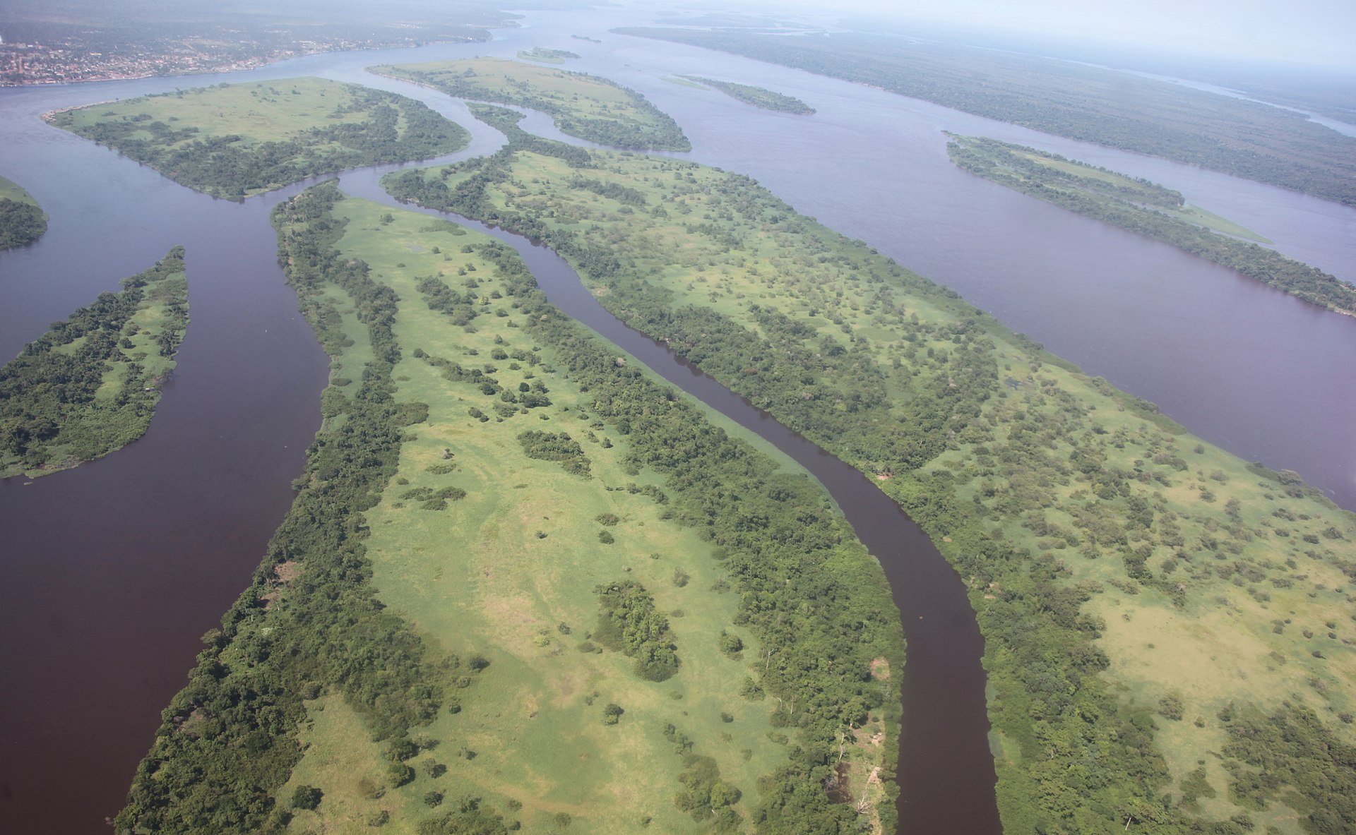
Eventually we hopped out of the van gathered up our gear and box lunches, and started up the trail. In the beginning, it was a path that was very easy to follow, and while it started off a bit steep, it soon leveled out some, giving us a chance to catch our breath along the way. It was also an early opportunity to take in some of the scenery, which was striking, although a bit muted due to low hanging clouds, and the threat of rain.

Soon, the trail turned upwards at a steeper grade once again, and we moved out of the Andes forest and into the marshlands that cover much of the upper sections of the mountains. This proved to be tough going, as the tall grasses that grow on the side of Pasochoa can conceal uneven ground, slick mud, dense roots and a host of other obstacles waiting to trip you up. On top of that, the grass is so thick, and soft, that it almost makes using trekking poles impossible. Not only do the tips of the poles snag on the grass itself, they also sink deep into the blades, sometimes providing no real assistance at all.

It took about three hours to reach the summit of Pasochoa, with the altitude and terrain being the biggest challenges of course. The route, which was often lost in the grass, was a test for the legs and lungs, with a fairly steep angle to the approach ridge. While the altitude certainly left me gasping for air a few times, it was the grass that ultimately proved my biggest nemesis. It would continue to do so throughout the day, but on the last push to the top, I simply gave up using my trekking poles, and resorted to pulling myself upwards using the dense plants as my method of stabilizing myself.

At one point, we moved off of the grass, and onto the rocky summit, and it was far easier moving across the solid ground than it was the unpredictable marsh lands below. Once on the rocks, it was an easy climb to the top, where we took a brief break to enjoy some snacks, and take in the view. Unfortunately, the clouds that has been following us that morning were still around, so there wasn't much to see from the top. Still, on occasion the mists would part briefly to give us a glimpse of the lovely valley below, providing a tantalizing look at what must be an amazing site on a clear day.

Before departing from the summit, two of our guides took a moment to thank the mountain and nature for allowing us to hike to the top. They spoke briefly in Quechua – the native language of the highlands people – and the rest of the group repeated afterwards. The Quechua people have a deep connection with nature, and many of those traditions continue to run deep today.

After that, we descended from the top of Pasochoa and started the traverse across a mountain ridge towards our next goal. Unfortunately, the tall grass once gain made the descent a challenge, and covered the trail to a degree. At times, I felt like a clumsy ox as I trudged through the moorlands, sometimes stumbling on precarious footing, or sliding across the slightly damp blades of grass. My Andean guides suffered less than I did however, at times making it look effortless as we moved up and down the mountain. I envied their agility on the trail, as it was clear that they had lots of experience in this environment.

Our trek continued up and down the route, until we defended across a narrow saddle. At that moment, the skies cleared briefly once again, and the surrounding landscapes were revealed through the clouds. I was once again struck with how lovely the views must be on a clear day, as they were certainly impressive even on our trek, which was ensconced in mist and shadow for most of the hike.

Soon, the clouds closed in once again, and we continued along the trail, which rose up to our second summit of the day. Not nearly as challenging as Pasochoa, it never the less gave us some fine views, including some highlands ponies that were grazing in the lush pastures near by. At this point, it even looked like the skies might clear a bit, and provide us with a bit of sunshine for our afternoon walk. That thought was fleeing however, and soon the gray skies rolled in once again.

We were now more than four hours into the hike, so we decided to descend further down the trail before stopping for some lunch. That was when those dark clouds that had been following us all day decided to make our lives just a little bit tougher. The rains came in a few large, cold drops at first, but it soon started to downpour in steady fashion. We had all slid into our rain gear at that point, and were in doing our best to continue along the trail. By now, the thick grasses where soaking wet, making it even more difficult to navigate through the marshlands.

I have often said on this blog that there is no such thing as bad weather, just bad gear, and never was that more accurate than today. The heavy rains would soak through any equipment not designed to repel lots of water, and thankfully most of my gear lived up to the challenge. For some reason however, my boots took on water, despite the fact that they have never had issues in the past. The result was wet, cold feet for the latter section of the hike.

Eventually, we weren't just getting rained on, but had small pellets of hail thrown at us at well. By this point, even if we were dry, most of us were at least a little cold. We had to climb one last steep ridge, before beginning the final descent to the trails termination point, and while going down made things a lot easier, we still had a good distance to go before we could find respite of the downpour.

Thankfully, we eventually moved out of the marshlands and back into the Andean forest, which helped provide a bit of shelter, as the rain started to lessen some. At that point, we were actually back on a clearly defined trail – the first in hours – which helped make the descent an easier one. Soon, we even left the forests behind, and were trekking through farmland pastures, with our mountain lodge even in sight. Knowing that we were close to a dry shelter from the on-going storm spurred us on.

At long last, we reached the Cotopaxi Pungo mountain lodge, which would be our accommodations for the evening. I had expected to walk into a warm, dry location, that offered few amenities, other than a hot shower, a good meal, and a place to sleep. What I found instead is an amazing hotel nestled in the Andean highlands. As I write this, I can see views of the mountains around us outside the large windows, while lively flames dance in the fireplace. Tranquil music plays out of speakers overhead, as I'm comfortably working away on a couch in the common area. The rooms are even more comfortable, with kingsized beds, a spacious living area complete with a fireplace of its own, and a shower that was even better than I had imagined. In short, this is another wonderful Ecuadoran hotel to add to your list, as it has an impeccable, friendly staff dedicated to keeping their guests happy. And when the skies clear, it offers some of the most incredible views of Cotopaxi that you'll find anywhere.

I'm sure if you've read this entire report of my day, you must be thinking that it was a miserable one. But despite the challenges of the trek, which includes the inclement weather, it was actually a very good hike. Would it have been better without the heavy rain? Of course! But I'm in Ecuador during the rainy season, and poor weather is possible at nearly anytime. I've actually been fortunate that for the most part the weather has been beautiful. But sometimes, the mountains can be difficult, and today was one of those days. I still greatly enjoyed reaching the summit of Pasochoa, and the rest of the trek was also a lot of fun, despite the challenges we faced along the way.

My advice is that if you plan to do this trek during the rainy season (October - April), you should come prepared to deal with rainy weather. I think you'll still find it to be an excellent walk. If you come during the dry season (May - September), the skies will be clearer, but the winds can be extremely high, creating colder conditions. Dress warmly, particularly for your summit push.

Tomorrow, I'll continue trekking with Tropic on another long hike along the Padregal Trail. I'm told that this one is easier than today, with gentle trails through the grasslands once again. If the weather improves, it is also suppose to extremely scenic, with great views of the surrounding mountains. Here's hoping we get some good weather for that hike, as I'd love to get some great photos to share with everyone. I'll keep you posted on that trek too.
More aboutAdventures in Quito: A Mountain Trek During Which Ecuador Reminds Me That it is The Rainy Season!

Himalaya Fall 2014: Final Numbers from Blizzard in Nepal are Sobering

Posted by Unknown on Thursday, October 30, 2014

It has been a little more than two weeks since the incredibly strong blizzard – spurred on by cyclone Hudhud in the Indian Ocean – hit Nepal, creating a tragic scene in the Himalaya as a result. Now that things have finally calmed down there, and mostly returned to normal, we're beginning to get a better understanding of the scope of what happened, and just how deadly the storm truly was.

According to official reports, 43 people lost their lives in the blizzard, most of whom were Nepali, although there were also casualties from Canada, Israel, India, Japan, Poland, and Slovakia as well. In the days that followed the storm, more than 70 helicopter flights were made, carrying  514 people out of the the mountains. This is, by far, the largest search and rescue operation ever conducted in Nepal, with evacuations on a massive scale. To make matters worse, there are still some Nepali's that are believed to be missing, which means the number of dead could still go up from here.

As mentioned previously, Nepal's government has vowed to make changes that will improve the safety of foreigners visiting the Himalaya. New regulations governing how trekkers travel in the mountains are expected to be announced before the start of the spring season in April, with the possible requirement of hiring a local guide, and carrying a GPS tracker, as part of the discussion. Officials have also indicated that they are seeking ways of improving weather forecasting, and more efficient means of sharing those forecasts to remote regions.

All of these suggestions sound like good ones, but the problem is that we've heard this kind of rhetoric out of Nepal before. There have been announcements in the past stating that trekkers would be required to hire local guides, but those rules have not been enforced, and many travelers still hike the Himalaya independently. There is little indication that things will be different this time, in part because Nepal's track record has been so spotty over the years.


Case in point, last year it was announced that the Nepali government would have a more active presence in Everest Base Camp following the much-publisized dispute between three high profile climbers from Europe, and an angry mob of Sherpas back in the spring of 2012. There were suppose to be more liaison officers in BC, and even a number of military and police officers as well. When the tragic avalanche hit the mountain on April 18 of this year, claiming the lives of 16 men, there were almost no government officials in Base Camp at all. Witnesses to the accident have since said that having liaison officers there could have facilitated rescue operations, but instead they were hindered by the lack of an official government presence on the mountain.

Every expedition to Everest is also suppose to be accompanied by their own assigned liaison officer, but many of those officials never make it to the mountain either. The funding to support that infrastructure isn't always there, despite the fact that mountaineers pay a fee that is suppose to specifically pay for the expenses of those officers.

Despite the ongoing problems with dealing with the Nepali government, there were other factors at play that helped create this tragedy as well. The ferocity of the snow storm so early in the fall caught many people off guard, and they simply weren't prepared to deal with it. The fall is typically a great time to be in the Himalaya, but this storm was just completely unexpected.

It also doesn't help that many trekkers show up completely unprepared for their journey. They often lack the proper gear, and level of fitness, for a challenging  hike, and have no idea what kind of weather to expect. I've witnessed this first hand while in Nepal, as people that I trekked with brought sleeping bags that weren't rated properly for the temperature, didn't have proper clothing, or even a hat. As a result, they ended up suffering along the way, even when conditions were relatively good.

Clearly, there is room for improvement all around. Trekkers need to be more knowledgeable and prepared for what they are in for, and pack for adverse conditions. Meanwhile, the Ministry of Tourism in Nepal needs to continue to seek ways to improve safety for travelers, and actually enforce those regulations strictly.

Nepal is an amazing, wonderful country, with great culture and some of the most stunning landscapes on the planet. I would certainly encourage any traveler to visit if they have desire. But when you go, make sure you're fully prepared for the experience. In the long run, it'll make it that much better for you.
More aboutHimalaya Fall 2014: Final Numbers from Blizzard in Nepal are Sobering

Gear Closet: adidas Terrex Swift R Mid Women's Hiking Boot

Posted by Unknown on Monday, October 27, 2014

The search for the perfect hiking boot can be a daunting proposition at times. When we're plunking down our hard-earned cash, we of course want boots that are comfortable, provides plenty of support, and fit our feet properly. They should also be durable enough to survive many adventures in the backcountry, and it doesn't hurt if they look good too. For us men, the challenge of finding something that meets all of those qualifications can require a great deal of patience, even though we tend to be less concerned with what we put on our feet. Imagine how difficult it can be to find the right hiking show for a woman, many of whom put far more thought into their footwear than we ever will.

Recently, my better-half has had the chance to test out the Terrex Swift R Mid women's hiking boot from adidas, a company that is more well known for its basketball, soccer, and running shoes. But over the past few years, adidas has quietly built a great collection of outdoor gear, some of which is incredibly innovative, and delivers a high level of performance.

The designers at adidas have taken their extensive knowledge of sports and athletics, and brought some of that sensibility to the outdoor gear market as well. As a result, their hiking boots and apparel tend to be lightweight, performance focused, and incredibly well built. I have met with reps from adidas several times over the past few years while attending the summer Outdoor Retailer show, and each time I've come away very impressed with what they have in the pipeline. In fact, I've wanted to get my hands on a pair of their Terrex hiking boots for some time, but jumped at the chance for them to outfit my fiancé instead. She has been in need of a good pair of hiking boots for some time, and was struggling to find something that fit her needs. Fortunately, adidas had something that provided the fit she was looking for, as well as comfort that rivaled the sneakers that they are so well known for.
Just one look at the Swift R Mid, and you can tell that you're not going to encounter anything else like them out on the trail. They definitely have a unique design, and the color combinations are unique and attractive, without becoming overly obnoxious. With a background that is deeply rooted in the athletic shoe market, adidas could have easily gone overboard with their color combinations, but I feel they managed to strike a good middle-ground with giving these shoes a distinct look that shouldn't immediately turn off most hikers.

Out of the box, the Terrex boots are a bit stiff, and it has taken some time to break them in. In fact, my SO had a difficult time even getting her foot in the shoe at first, as the portion of the boot that provides high-ankle support didn't provide a lot of give. But after wearing them for a bit, they've loosened up some, providing better access over time. That same portion of the show does help to keep the ankle from rolling on uneven ground however, and it seems these boots are a good fit for anyone who requires that extra support.

Built with a number of adidas' own proprietary fabrics and materials, the Terrex Swift is built to be very breathable, while also remaining extremely durable as well. The company did use a lightweight Gore-Tex liner however, which makes the interior of the shoe waterproof, while still managing to wick moisture away from the foot. The same liner should provide a level of warmth on cool-weather, or early winter hikes, too.

Built like a lightweight hiking boot, but with the soul of an athletic shoe, the Swift performs well on the trail. Its outsole is built to provide a solid grip on a variety of surfaces, even in wet conditions. It is also made designed to be agile and fast on the trail as well, which makes this shoe a great choice for everything from light hiking to fast packing to adventure travel. Its level of comfort is unmatched, and because it is lightweight, it is also very packable.

Not everything was rosy with these boots however. After our initial hike, my fiancé came home with a few blisters, even though she was wearing excellent hiking socks. Of course, everyone's foot is different, and blisters can occur for a variety of reasons, but it is important to point out that they did occur. I've found that over time, hiking boots tend to loosen up some, and blistering tends to go away, but as with any athletic shoe, it is important to get the right fit, and wear appropriate socks too.

Overall, the adidas Terrex Swift R Mid gets a thumbs up with my favorite female gear tester. Lightweight and comfortable, they bring a unique styling to the trail, while also offering solid performance that belies their athletic shoe heritage. With a price tag of $160, they fall squarely into the mid-range level of hiking shoes, but provide plenty of high-end amenities. If you're in the market for a good pair of hiking boots (adidas makes a men's version of the shoe as well), and you're looking for something that is built for speed, then take a look at the Terrex Swift. Chances are, you won't be disappointed.

More aboutGear Closet: adidas Terrex Swift R Mid Women's Hiking Boot

Himalaya Fall 2014: Summit Bid Underway on Makalu, New Rules for Trekking in Nepal

Posted by Unknown on Wednesday, October 22, 2014

The fall climbing season in Nepal is rapidly coming to a close, and as such, teams are making final preparations for their summit bids, particularly on Makalu. Meanwhile, in the aftermath of that massive blizzard that claimed the lives of more than 40 people in the Himalaya last week, the Ministry of Tourism has announced new regulations designed to help keep trekkers safer in the mountains.

We'll start today on Makalu, where the British Tri-Service team has put a team of climbers in place high on the mountain with the hope of reaching the summit as early as tomorrow. Climbing along the very long, and difficult, Southeast Ridge the designated 4-man summit team has now reached Camp 4, where they are currently resting before setting off for the top tomorrow morning. The weather forecast indicates three good days ahead, and they hope to take advantage of that open window if possible. The team is reportedly in good spirits, and fine health, and expectations are riding high as they begin the final stages of the expedition. A support team is standing by to lend aid should the summiteers need it, but they are anticipating a good approach to the top of the mountain. Heavy snows may have created unstable conditions however, and break trail to the top could be exhausting and time consuming. Still, they are ready to proceed in alpine style above C4. Watch for more updates over the next few days.

There is still no word from the Madison Mountaineering team, which was also attempting Makalu along the Northwest side of the mountain. They launched a summit bid last Saturday, but have not posted any status updates since. There have been some rumors that indicate that they were turned back high on the mountain due to unstable conditions, but we have not received confirmation of that at this point.


Over on Lhotse, the Korean team is back in Base Camp after another rotation up the mountain. Conditions on the mountain continue to be challenging, but they are forging ahead with their plans. There are no indications of when the team will launch its summit bid, but they have been on Lhotse for weeks now, with slow progress being made. Fortunately, the squad seems very patient, as they wait for their opportunity.

Finally, in the wake of the disastrous blizzard that swept through the Himalaya last week, Nepal has announced some changes to help protect trekkers visiting the country. They have once again reiterated that all hikers will need to be accompanied by a local guide, which is something that they have said in the past, but seem to not enforce all that tightly. Representatives from the Ministry of Tourism have also said that trekkers will be required to carry GPS tracking devices, which will make them easier to locate should another emergency situation arrive. Furthermore, the government is promising better weather forecasts to help more accurately report conditions prior to trekking groups setting off. All of these efforts are designed to keep travelers safer of course, while continuing to allow access to the best trekking routes the country has to offer.

Anything that helps make the experience safer is, of course, a good thing. It is important to acknowledge that this was a freak and unexpected storm, and while I'm sure there were some poor choices made on the parts of guides and trekkers, the blizzard that hit the Himalaya last week was not in any way typical for this time of year. Still, these moves will hopefully ensure a safer environment traveling in Nepal. The country has seen its share of tragedy this year, and its tourism industry could take a hit because of it. That would be a shame however, as the country is beautiful, accommodating, and filled with wonderful adventures.

That's all for today. More to come from Makalu in the next day or two.
More aboutHimalaya Fall 2014: Summit Bid Underway on Makalu, New Rules for Trekking in Nepal

Himalaya Fall 2014: Nepal Ends Search For Missing Trekkers, Summit Bids Begin on Makalu

Posted by Unknown on Monday, October 20, 2014

It was another busy weekend in the Himalaya, but sadly for all the wrong reasons. Search and rescue teams spend the past couple of days sweeping through the mountains in search of missing trekkers who were caught out in that horrific blizzard that struck Nepal last week. The weather has improved considerably since then, but a number of people are still missing, and feared dead, in what has become the worst tragedy in the history of the Himalaya.

Efforts to locate missing trekkers and locals were continuing today, even though the SAR teams have started to scale back their efforts. All told, more than 40 people lost their lives in the storm, while 600 had to be rescued. Most of those were in the Annapurna region, where the storm seemed to hit the hardest.

Over the weekend, the popular Annapurna Circuit was shut down, while rescue efforts were conducted. When it was finally opened again, new trekkers, just setting out on their hike, ran into trouble as well, and had to be evacuated. This prompted officials to shutdown the trail once again, in order to keep others from becoming stranded.

As recently as today, ongoing avalanches have hampered efforts to locate those who are still missing. Despite those challenges however, a search team located the body of a missing Israeli traveler, which brought the death toll to 40, with others still to be found.


Typically this time of year we focus on the climbing efforts in Nepal, as mountaineers take advantage of the good weather that follows the summer monsoons. But trekkers arrive in high numbers in the autumn too, as it is usually the best time of year for hiking in the region as well. This freak snow storm caught many off guard, including the locals who live in the mountain. This type of blizzard isn't common, even in the winter, and it arrived with so much speed and ferocity, that its strength was underestimated, which is why so many people ended up stranded and dead.

Elsewhere, the climbing teams that remain in Nepal are continuing to press ahead. The British Tri-Services team is now in place at Camp 3 on Makalu, and are preparing for the final push to the summit in the next couple of days. They'll use C3 as a launching pad for what will now become an alpine style ascent. The weather is reportedly very good, and is expected to remain that way throughout the week, giving them the best opportunity to summit that they've seen yet this season. Four members of the team will be on the move tomorrow, with the hope that they can top out by Wednesday or Thursday, depending on how quickly they can make progress along the long, and difficult Southeast Ridge.

On the other side of the mountain, the Madison Mountaineering team launched their summit bid on Saturday, but reportedly were forced to turn back due to high risks of avalanche along their route. The team has not updated its dispatches in a couple of days however, so these reports are unconfirmed at this point. Typically, if they did abandon the attempt, they would be back in Base Camp by now, and would have sent a dispatch confirming their plans. Hopefully all is well, and we'll get an update on their progress soon.

Finally, there has not been any significant updates from the Korean team on Lhotse in the past few days. The last we heard, they were preparing to push up to C3 and establish their camp at that point on the mountain. They have most likely waited out the storm as well, and will be back on the move over the next couple of days, but progress has been slow all season. Hopefully we'll get an update soon.

That's all for today. It seems then worst of the crisis has passed, although conditions remain dicey throughout the region. Hopefully there will be  no more deaths due to the poor weather, and both trekkers and mountaineers will return safely from their adventures.
More aboutHimalaya Fall 2014: Nepal Ends Search For Missing Trekkers, Summit Bids Begin on Makalu

Himalaya Fall 2014: More Trekkers Rescued, Search Continues For Those Missing

Posted by Unknown on Friday, October 17, 2014

I wanted to post an update on the ongoing crisis in Nepal, where dozens of trekkers are still missing, even as search and rescue operations are being conducted. The weather has improved across the Himalaya, allowing SAR teams to reach some of the areas that have been cut off for the past few days, and as a result more trekkers are being airlifted from the mountains. Sadly, the number of deaths attributed to this unexpected, and incredibly powerful, blizzard continues to rise as well, with officials saying that at least 29 people have now lost their lives as a result of the bad weather.

Earlier today, search teams were able to reach the Thorung La pass on the Annapurna circuit, where they were able to locate 40 trekkers, and evacuate them to safety. The pass was at the center of the storm, and as a result, many of the deaths have occurred near there. According to some reports, a number of the deaths occurred because the hikers caught in the pass tried to descend and escape the blizzard, with some freezing to death as a result.

Officials from the Ministry of Tourism say that the death toll will likely continue to mount, as there are still a lot of trekking routes to be checked, and heavy snow still hinders the search. Yesterday alone, more than 200 trekkers were rescued, and they suspect that there are still more waiting to be found. Operations will continue through the weekend in the hopes of rescuing more stranded backpackers, and recovering bodies.


Sadly, the finger pointing game has already begun, with some of the trekkers firmly placing blame for this disaster on the guides. In one BBC story, hikers say that the guides were ill equipped to deal with the poor weather, and made the wrong choice of continuing into the mountains, even when they knew the forecast called for heavy snows. One of the trekkers is quoted as saying that the guides pressed the team to move forward, even though the snow was so bad that it had become disorienting, and no one knew where they were going. He describes a harrowing tale of descending for two hours along a trail that no one could see, as they searched for marking poles in whiteout conditions that are described as an "abyss of nothing."

Meanwhile, over on Makalu, the British Tri-Services team have launched their summit bid as expected. They report sunny skies and clam winds as the squad begins their climb. They reached Camp 1 yesterday, and discovered one of their tents was crushed by the weight of the snow that had fallen, but they were able to make alternate means of sleeping, and repaired the damage this morning before moving up further. Hopefully they'll find conditions remain solid on their way up. The heavy snows could make things unstable, but so far the team is happy with their progress.

That's the latest from Nepal. While it seems certain that the number of trekkers killed by the storm will continue to climb, lets hope it doesn't increase by many more. With the weather improving there, the worst of the situation is now behind us.
More aboutHimalaya Fall 2014: More Trekkers Rescued, Search Continues For Those Missing

Himalaya Fall 2014: Avalanche Claims Lives of Climbers on Dhaulagiri, Death Toll Amongst Trekkers Rises

Posted by Unknown on Thursday, October 16, 2014

The bad news out of Nepal continues today, with more reports of avalanches claiming the lives of both trekkers and climbers there. The forecast has called for improving weather conditions across the region, but unstable snows are making some of the trekking routes dangerous, not to mention the upper slopes of many of the mountains. The unexpectedly bad weather has hit the country hard, and as a result, the death toll continues to rise.

Yesterday, I reported that 17 trekkers had perished in two separate avalanches near Annapurna and in the Manang district. Today, we get word that that number has climbed to 26 foreign visitors, and may be as high as 32, with more than 100 people still missing. The situation is very fluid at the moment, with dozens of trekkers stranded throughout the region. Some are believed to be suffering from frostbite and dehydration, as they wait for rescue, or for conditions to improve enough that they can proceed to a village where they can receive aid.

The incredibly bad weather is the result of cyclone Hudhud coming ashore in India, and creating unusual conditions in the Himalaya as a result. Heavy snow and and rains have fallen over Nepal for the past several days, creating conditions that don't typically occur during the fall trekking and climbing season. Normally, autumn is the best time of the year to go hiking in Nepal, but this year it has become a dangerous nightmare for many travelers.

In addition to the numerous trekkers who have been killed, or stranded, we've also received word that an avalanche has claimed the lives of several climbers on Dhaulagiri as well. The 8167 meter (26,795 ft) peak is the 7th highest mountain in the world, and was the target of a team of Slovak climbers this fall. Two members of that team – Jan Matlák and Vladimir Švancár –  along with three Nepali guides, were killed in an avalanche that swept through Base Camp yesterday. The team had established Camp 1 and 2 on the mountain, and were waiting for the storm to pass before they attempted a summit push.  As you would expect, the expedition is now over, and the eight remaining members of the team have been evacuated back to Kathmandu.


Meanwhile, over on Makalu, the British Tri-Service team is gearing up for their summit push after waiting out the storm. Their forecast indicates good weather well into next week, and they now aim to take advantage of the open window. The squad launched their summit bid earlier today, with the hopes of reaching the summit possibly by this weekend. Of course, snow conditions will have a major impact on their progress, and they could still face a great deal of instability as they move up. Additionally, breaking trail through fresh snow on their long summit push up the Southeast Ridge could be brutally hard as well. Lets keep our fingers crossed that they are able to get up and down the mountain safely.

Similarly, the Madison Mountaineering team is also preparing for their summit push. They report 30 cm (11.8 inches) of new snow in BC, but also indicate overall conditions are good. They hope to begin the next phase of their climb in a day or two as well. They are climbing along the Northwest side of Makalu, where conditions could be very different from what the Brits will encounter.

Finally, the Korean team on Lhotse has updated their Facebook page to express their concerns and well wishes for those who have been caught in the bad weather and avalanches across the Himalaya these past few days. The team has been experiencing these poor conditions since they arrived on the mountain over a month ago. But, they are continuing to press ahead with the expedition, and will climb up to Camp 3 to begin stocking that site tomorrow. Lets wish them the best of luck as well. Avalanches have been prevalent on Lhotse this fall even before the big storm dumped more snow on the mountain.

This has been an incredibly bad year for Nepal, and this current round of tragedies are worse than anything the tourism industry has ever seen there. When an avalanche claims the lives of climbers on one of the big peaks, it is a sad story for sure. But climbers also assume a certain level of risk when they step foot on the mountain. For the trekkers, the routes are generally very safe, and they never face the kinds of conditions that would be life threatening – at least not on this scale. This story is a grim reminder of just how powerful mother nature can be, and the kind of damage she can inflict when we're unprepared for the absolute worst.

There is no one to blame here. The trekkers have just been caught in poor circumstances. But that doesn't lessen the tragedy one bit. My condolences go out to the friends and families of those who have lost their lives these past few days. Hopefully no more will suffer and die in the days ahead.
More aboutHimalaya Fall 2014: Avalanche Claims Lives of Climbers on Dhaulagiri, Death Toll Amongst Trekkers Rises

Help Tusker Trail Pick Their Next Trek, Win An Adventure Of Your Own!

Posted by Unknown on Wednesday, October 15, 2014


Tusker Trail, one of the best adventure travel companies in the world, is asking us to help them select their next trekking detonations, and as an added incentive, their giving away one of their great trips to one lucky winner.

Tusker's current trekking catalog offers some excellent opportunities to go hiking in some of the best locations on the planet, including Kilimanjaro in Africa, as well as Everest Base Camp in Nepal. They also offer trips to places like Mongolia and Bhutan, allowing clients to see some very remote regions of the world. But, the company is looking to expand their offerings, and that is where you can help.

The Tusker Facebook page is currently hosting a contest that allows us to vote for the next detonation that the company should add to its catalog. Options include New Zealand, Machu Picchu in Peru, Greenland, Australia, Myanmar, the Dolomite of Italy, Patagonia, and the Ladakh region of India. Each of those is a fantastic adventure destination, with a lot to offer travelers. Some are classic places that everyone should see at some point in their lives, while others are emerging as exciting new destinations that are luring adventurous travelers with their beautiful landscapes and interesting cultures.

To enter the contest, just visit the Facebook page, and vote for your choice for Tusker's next trip. You'll then be automatically entered to win your choice of four Tusker treks. Those include a Kilimanjaro climb, a hike across Mongolia, a visit to Bhutan, or the classic expedition to Everest Base Camp.

The contest is open through the end of October, at which time a winner will be chosen at random. That person will be notified the first week of November, at which time they can select the trip of their choice.

This is a great opportunity to win a trip from one of the best trekking companies around. Who knows, you could be off on a grand adventure of your own soon!
More aboutHelp Tusker Trail Pick Their Next Trek, Win An Adventure Of Your Own!

17 Trekkers Die in Nepal Due to Poor Weather

Posted by Unknown

More sad news out of Nepal today, where there are reports that at least 17 trekkers have died over the past two days as a result of heavy snow and unusually bad weather in the Himalaya. The poor conditions have been spurred on by the arrival of cyclone Hud-hud in eastern India. While the storm isn't hitting Nepal directly, it is altering atmospheric conditions in the region, creating dangerous conditions in the mountains as a result.

According to CNN, a dozen of the travelers who have died were hiking in the Annapurna region, one of the most popular trekking destinations in the entire world. The group was hiking through the famed Thorung La Pass in Mustang district, located at 5416 meters (17,770 ft) when they were struck by an avalanche. So far, only four bodies have been recovered, with eight more still buried under the snow. The fear is that there may be many more trekkers stranded or killed in the mountains, but the poor conditions are making it impossible to know for sure right now, and disrupting communications to and from the area.

The other five trekkers who have been confirmed to have perished included four Canadians and one Indian travelers. They were exploring the remote Manang region yesterday, and their bodies were discovered today. The exact cause of death hasn't been made clear, but has simply been blamed on "heavy snow." That would indicate that perhaps another avalanche occurred.

Fall is a popular time for climbing and hiking in the Himalaya, but typically it isn't a dangerous time to be there, particularly for trekkers. It is unusual for backpackers to run into problems on the popular trekking routes, such as the Annapurna Circuit or the walk to Everest Base Camp. The incredibly bad weather is altering that perception however, as the CNN article indicates that 38 more trekkers were rescued by army helicopters today as well.


Unfortunately, CNN also took this opportunity to rehash the avalanche on Everest last spring, and compare that accident to what is happening now. It is important to point out that climbing an 8000 meter peak is in no way like trekking in the region. The trekking routes are generally safe, include numerous villages and tea houses, and are found at lower altitudes. It is not unusual for avalanches to occur high on the mountains, but these events impacting trekkers in the Himalaya are far from the norm.

Thousands of travelers visit Nepal on a yearly basis, and a lot more of them are there to hike the mountains, rather than climb them. Trekking in the region is a strenuous, challenging activity, but rarely is it dangerous. The conditions in the Himalaya must be incredibly bad indeed if they are causing the deaths of so many people. Let hope the climbing teams that we've been following the fall continue to be safe in the days ahead as well. Most are preparing summit bids for the coming days.

I'll keep you posted as more news of these trekking deaths is released.
More about17 Trekkers Die in Nepal Due to Poor Weather

Video: Filmmaking in the Himalaya with a Drone (Part 2)

Posted by Unknown on Friday, September 26, 2014

A few weeks back I posted a video from my friend Jon Miller of The Rest of Everest fame. In that video, we got a behind the scenes look at a recent trip Jon made to the Himalaya, during which he took a couple of drones along with him to capture some amazing footage from across the region. Today, we have a second video from that trip, which once again not only includes fantastic images from the mountains, but also gives would-be Himalayan trekkers an opportunity to see what it is like to hike through that part of the world. This video will be of interest to other filmmakers of course, but there is a lot to like for the rest of us too. I hope you enjoy.

More aboutVideo: Filmmaking in the Himalaya with a Drone (Part 2)

U.S. Rotarians Climb Kilimanjaro to Eliminate Polio

Posted by Unknown on Wednesday, September 24, 2014

Earlier this month, a team of climbers representing Rotary Clubs from all over the U.S. launched a charity climb of Mt. Kilimanjaro in Africa in an effort to raise funds for the End Polio Now foundation. The group hopes to raise as much as $300,000 through their efforts, with the goal of stamping out polio worldwide once and for all.

The group climbed Kili, the tallest mountain in Africa at 19,340 ft (5895 meters), along the Rongai Route a few weeks back. They were led by guides from Zara Tanzania Adventures, including American Macon Dunnagan, who was making his 35th ascent of the mountain. It took the nine climbers six days to reach the summit, along a path that is known for being one of the less used, and more difficult routes to take to the summit.

This Kilimanjaro climb has become somewhat of a tradition over the past few years. Members of the Rotary Club have undertaken treks to the summit in both 2012 and 2013. Two  years ago, their efforts allowed them to raise $106,000 for the End Polio Now fund. This year, they have set their sights much higher, and they expect to reach their goal, even though the climb is over.

Kilimanjaro is the tallest free-standing mountain in the world. The dormant volcano draws thousands of adventurous travelers each year, as the climb is a non-technical one that mostly involves acclimatizing to the altitude, and trekking to the summit over  6 or 7 days. For many, it is a good introduction to hiking in rough terrain at altitude, which could lead to similar adventures elsewhere in the world, such as the Himalaya or the Andes.

I want to congratulate the Rotary team on achieving one of their goals by reaching the summit. They continue working towards their other goal, which is raising funds to stamp out polio across the globe. Certainly another worthy cause.
More aboutU.S. Rotarians Climb Kilimanjaro to Eliminate Polio

Video: Above Sea Level (Climbing Mt. Kenya and Kilimanjaro)

Posted by Unknown on Monday, September 22, 2014

Here's a fun and creative video that follows two climbers as they go up both Mt. Kenya and Kilimanjaro in Africa. The men carried a GoPro camera with them on their trek, and shot some funny video at various points along both mountains that captured their mood at each step of the climb. It is a not-so-serious look at scaling both peaks that is good for a few chuckles along the way.

Above sea level from Miguel Campos on Vimeo.
More aboutVideo: Above Sea Level (Climbing Mt. Kenya and Kilimanjaro)

Video: Filmmaking in the Himalaya with a Drone

Posted by Unknown on Monday, September 8, 2014

Last spring, my friend Jon Miller, from the The Rest of Everest video podcast, took a drone with him when he traveled through Bhutan, Nepal, and Tibet, capturing some spectacular footage from the Himalaya along the way. Last week, he posted another video from the trip, this time giving us a behind the scene's look at how he put his TurboAce Matrix E quadcopter drone through its paces. If you've wondered how these drones are used, or how you could possibly use them on your next project, this is a good video to watch. It also features some fantastic footage of the trek through the Khumbu Valley on the way to Everest Base Camp.

More aboutVideo: Filmmaking in the Himalaya with a Drone